Glonass
GLONASS (GlONASS) is a Russian-made global satellite navigation system. It has been in existence since the late 1950s, but only became widely used in the civilian sector in the 2000s. It is currently part of the Russian Federation.
It is often said that "GLONASS is an analogue of GPS", but this is not the case. Soviet scientists began creating satellite navigation systems earlier than Americans: in the Soviet Union, the foundations of the technology were developed in 1958, while in the United States, they considered using spacecraft to navigate Soviet satellites after the first artificial Earth launch in 1959.
The GLONASS orbital constellation consists of 26 satellites, one of which is in the stage of entering the system.

The location of the satellite
The GLONASS satellites are placed on three planes, which tilt towards the equator at a nominal Angle of 64.8° and rotate with a period of 11 hours, 15 minutes and 44 seconds. They move asynchronously with the rotation of the Earth. This provides a stable orbital system that, unlike GPS orbits, requires little correction to the spacecraft's orbit. Moreover, even if several satellites are taken out of orbit, this will not affect navigation availability on the territory of the Russian Federation. GPS satellites, in turn, are tilted about 55 degrees across six planes and rotate synchronously - they require ground correction stations for accurate geolocation.
Data transfer method
Information transmitted by satellites is encrypted using different protocols: GLONASS has FDMA, a more energy-intensive protocol with better data protection; GPS has an economical and less secure CDMA.
positioning error
For GLONASS, it is 3-6 m, for GPS, it is 2-4 m.
Coverage
GLONASS covers 100% of the territory of the Russian Federation and 70% of the Earth. GPS, on the other hand, can work anywhere except latitudes near the polar circle - the problem is the inclination of the orbit.
Big Dipper
The first step is the Beidou satellite navigation test system:
In 1994, China started the construction of the Beidou navigation satellite test System. In 2000, two Beidou navigation test satellites were launched in succession, and the Beidou Navigation Test Satellite System was completed, becoming the third country in the world to have an autonomous satellite navigation system. The launch of the third Beidou navigation test satellite in 2003 further enhanced the performance of the Beidou navigation test satellite system.
The second step is the Beidou navigation satellite system regional service:
In 2004, China started the construction of the Beidou Navigation Satellite System project, and by the end of 2012, five GE satellites, five GSO satellites and four MEO satellites had been equipped with regional service capabilities.
In 2017, Beidou 3 began to enter the intensive launch of satellites, and during the global networking period, at 2:09 on June 25, 2019, China successfully launched the 46th Beidou navigation satellite before carrying the fire with the Long March 3 B at the Xichang Satellite Launch Center.
The satellite is the 21st networking satellite of the Beidou-3 system and the second satellite in inclined geosynchronous orbit. By 2020, 30 Beidou-3 satellites will provide full services to the world.
The Beidou-3 space segment consists of 30 satellites, including three geostationary orbit (GEO) satellites, three inclined geosynchronous orbit (GSO) satellites and 24 medium circular Earth orbit (MEO) satellites. The operation control section includes more than 30 ground stations such as main control stations, injection stations and monitoring stations.
Compared with other GNSS, the biggest feature of the Beidou-3 system is that it has regional short message communication service and global short message communication service.
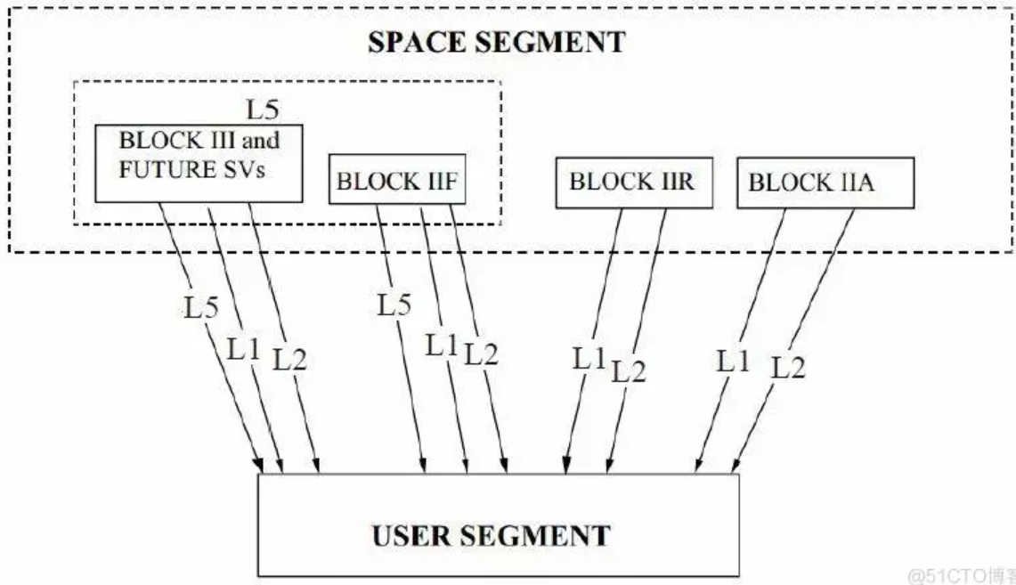
GPS


GALILEO Galileo
The three major investors in Galileo (Germany, France and Italy) have different goals for the development of the system. In 1999, these goals were condensed into one by a joint team of engineers from the three countries. On 26 May 2003, the European Union (EU) and the European Space Agency (ESA) officially approved the first phase of the project. Galileo is mainly used for civilian purposes, while the US Global Positioning System, Russia's Glonass system and China's Beidou system are more military-oriented. Galileo was only shut down for military purposes in some extreme cases. For both military and civilian terminals, the system provides the highest positioning accuracy.
On January 27, 2023/1/27, ESA announced at the 15th European Space Conference that after several months of testing by engineers at the ESTEC Technology Center, the Galileo Global Navigation Satellite System, which currently consists of 28 satellites, HAS been activated with its High Precision Positioning Service (HAS). Horizontal and vertical navigation accuracy can reach 20 cm and 40 cm respectively.

"Compared to Galileo Open Service, the calibration is very fast and very frequent - the satellite orbit is updated every 30 seconds and the satellite clock is updated every 10 seconds." "And the calibrated message HAS been designed in such a way that the right receiver can benefit from multiple satellite broadcasts to reconstruct the whole message very quickly," explains Daniel Blonksi, ESA's Galileo system performance engineer.
 CH
CH EN
EN


